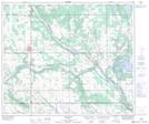
Maps showing Muriel, 10-57-6-W4, Alberta
Muriel is a Unincorporated area located in 10-57-6-W4, Alberta and has an elevation of 587 meters.
- Latitude: 53° 54' 19'' North (decimal: 53.9052777)
- Longitude: 110° 49' 11'' West (decimal: -110.8197222)
- Topography Feature Category: Unincorporated area
- Geographical Feature: Locality
- Canadian Province/Territory: Alberta
- Elevation: 587 meters
- Location: 10-57-6-W4
- Atlas of Canada Locator Map: Muriel
- GPS Coordinate Locator Map: Muriel Lat/Long
Muriel NTS Map Sheets