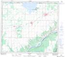
Maps showing Mushikitee Island, 22-81-24-W5, Alberta
Mushikitee Island is a Island located in 22-81-24-W5, Alberta and has an elevation of 329 meters.
- Latitude: 56° 2' 25'' North (decimal: 56.0402777)
- Longitude: 117° 40' 8'' West (decimal: -117.6688888)
- Topography Feature Category: Island
- Geographical Feature: Island
- Canadian Province/Territory: Alberta
- Elevation: 329 meters
- Location: 22-81-24-W5
- Atlas of Canada Locator Map: Mushikitee Island
- GPS Coordinate Locator Map: Mushikitee Island Lat/Long
Mushikitee Island NTS Map Sheets