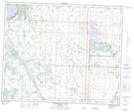
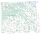
Maps showing Muskeg Creek, 11-45-28-W4, Alberta
Muskeg Creek is a River located in 11-45-28-W4, Alberta and has an elevation of 911 meters.
- Latitude: 52° 52' 6'' North (decimal: 52.8683333)
- Longitude: 113° 57' 11'' West (decimal: -113.9530555)
- Topography Feature Category: River
- Geographical Feature: Creek
- Canadian Province/Territory: Alberta
- Elevation: 911 meters
- Location: 11-45-28-W4
- Atlas of Canada Locator Map: Muskeg Creek
- GPS Coordinate Locator Map: Muskeg Creek Lat/Long
Muskeg Creek NTS Map Sheets