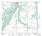
Maps showing Nampa, 19-81-20-W5, Alberta
Nampa is a Village located in 19-81-20-W5, Alberta and has an elevation of 575 meters.
- Latitude: 56° 2' 14'' North (decimal: 56.0372221)
- Longitude: 117° 7' 59'' West (decimal: -117.1330556)
- Topography Feature Category: Village
- Geographical Feature: Village
- Canadian Province/Territory: Alberta
- Elevation: 575 meters
- Location: 19-81-20-W5
- Atlas of Canada Locator Map: Nampa
- GPS Coordinate Locator Map: Nampa Lat/Long
Nampa NTS Map Sheets