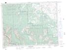
Maps showing Cherry Hill, 6-4-W5, Alberta
Cherry Hill is a Mountain located in 6-4-W5, Alberta and has an elevation of 1620 meters.
- Latitude: 49° 26' 59'' North (decimal: 49.4497221)
- Longitude: 114° 27' 5'' West (decimal: -114.4513889)
- Topography Feature Category: Mountain
- Geographical Feature: Hill
- Canadian Province/Territory: Alberta
- Elevation: 1620 meters
- Location: 6-4-W5
- Atlas of Canada Locator Map: Cherry Hill
- GPS Coordinate Locator Map: Cherry Hill Lat/Long
Cherry Hill NTS Map Sheets