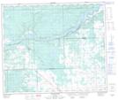
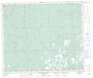
Maps showing Christmas Creek, 12-60-10-W5, Alberta
Christmas Creek is a River located in 12-60-10-W5, Alberta and has an elevation of 855 meters.
- Latitude: 54° 10' 1'' North (decimal: 54.1669444)
- Longitude: 115° 21' 32'' West (decimal: -115.3588889)
- Topography Feature Category: River
- Geographical Feature: Creek
- Canadian Province/Territory: Alberta
- Elevation: 855 meters
- Location: 12-60-10-W5
- Atlas of Canada Locator Map: Christmas Creek
- GPS Coordinate Locator Map: Christmas Creek Lat/Long
Christmas Creek NTS Map Sheets