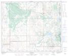
Maps showing Cipher Lake, 43-1-W4, Alberta
Cipher Lake is a Lake located in 43-1-W4, Alberta and has an elevation of 608 meters.
- Latitude: 52° 40' 57'' North (decimal: 52.6825000)
- Longitude: 110° 4' 21'' West (decimal: -110.0724999)
- Topography Feature Category: Lake
- Geographical Feature: Lake
- Canadian Province/Territory: Alberta
- Elevation: 608 meters
- Location: 43-1-W4
- Atlas of Canada Locator Map: Cipher Lake
- GPS Coordinate Locator Map: Cipher Lake Lat/Long