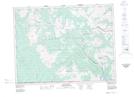
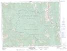
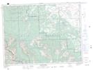
Maps showing Clark Range, 2,3-1,2,3-W5, Alberta
Clark Range is a Mountain located in 2,3-1,2,3-W5, Alberta and has an elevation of 2013 meters.
- Latitude: 49° 14' 1'' North (decimal: 49.2336110)
- Longitude: 114° 8' 5'' West (decimal: -114.1347222)
- Topography Feature Category: Mountain
- Geographical Feature: Range
- Canadian Province/Territory: Alberta
- Elevation: 2013 meters
- Location: 2,3-1,2,3-W5
- Atlas of Canada Locator Map: Clark Range
- GPS Coordinate Locator Map: Clark Range Lat/Long
Clark Range NTS Map Sheets
082G01 Sage Creek Topographic Map at 1:50,000 scale
082G07 Flathead Ridge Topographic Map at 1:50,000 scale
082G08 Beaver Mines Topographic Map at 1:50,000 scale
082H04 Waterton Lakes Topographic Map at 1:50,000 scale
082G Fernie Topographic Map at 1:250,000 scale
082H Lethbridge Topographic Map at 1:250,000 scale
082G07 Flathead Ridge Topographic Map at 1:50,000 scale
082G08 Beaver Mines Topographic Map at 1:50,000 scale
082H04 Waterton Lakes Topographic Map at 1:50,000 scale
082G Fernie Topographic Map at 1:250,000 scale
082H Lethbridge Topographic Map at 1:250,000 scale