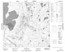
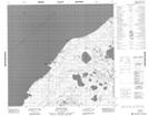
Maps showing Claussen Creek, 112-2-W4, Alberta
Claussen Creek is a River located in 112-2-W4, Alberta and has an elevation of 239 meters.
- Latitude: 58° 42' 28'' North (decimal: 58.7077779)
- Longitude: 110° 17' 21'' West (decimal: -110.2891669)
- Topography Feature Category: River
- Geographical Feature: Creek
- Canadian Province/Territory: Alberta
- Elevation: 239 meters
- Location: 112-2-W4
- Atlas of Canada Locator Map: Claussen Creek
- GPS Coordinate Locator Map: Claussen Creek Lat/Long
Claussen Creek NTS Map Sheets