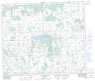
Maps showing Clear Lake, 60-6-W5, Alberta
Clear Lake is a Lake located in 60-6-W5, Alberta and has an elevation of 701 meters.
- Latitude: 54° 13' 34'' North (decimal: 54.2261111)
- Longitude: 114° 47' 14'' West (decimal: -114.7872221)
- Topography Feature Category: Lake
- Geographical Feature: Lake
- Canadian Province/Territory: Alberta
- Elevation: 701 meters
- Location: 60-6-W5
- Atlas of Canada Locator Map: Clear Lake
- GPS Coordinate Locator Map: Clear Lake Lat/Long
Clear Lake NTS Map Sheets