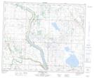
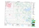
Maps showing Clearwater Creek, 50-24-W4, Alberta
Clearwater Creek is a River located in 50-24-W4, Alberta and has an elevation of 768 meters.
- Latitude: 53° 18' 23'' North (decimal: 53.3063888)
- Longitude: 113° 29' 39'' West (decimal: -113.4941666)
- Topography Feature Category: River
- Geographical Feature: Creek
- Canadian Province/Territory: Alberta
- Elevation: 768 meters
- Location: 50-24-W4
- Atlas of Canada Locator Map: Clearwater Creek
- GPS Coordinate Locator Map: Clearwater Creek Lat/Long
Clearwater Creek NTS Map Sheets