Maps showing Surprise Point, 43-2-W6, Alberta
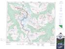
Surprise Point is a Mountain located in 43-2-W6, Alberta and has an elevation of 2084 meters.
- Latitude: 52° 40' 23'' North (decimal: 52.6730555)
- Longitude: 118° 15' 39'' West (decimal: -118.2608333)
- Topography Feature Category: Mountain
- Geographical Feature: Peak
- Canadian Province/Territory: Alberta
- Elevation: 2084 meters
- Location: 43-2-W6
- Atlas of Canada Locator Map: Surprise Point
- GPS Coordinate Locator Map: Surprise Point Lat/Long
Surprise Point NTS Map Sheets