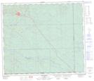
Maps showing Swan Hills, 14-66-10-W5, Alberta
Swan Hills is a Town located in 14-66-10-W5, Alberta and has an elevation of 1142 meters.
- Latitude: 54° 43' 00'' North (decimal: 54.7166666)
- Longitude: 115° 24' 6'' West (decimal: -115.4016667)
- Topography Feature Category: Town
- Geographical Feature: Town
- Canadian Province/Territory: Alberta
- Elevation: 1142 meters
- Location: 14-66-10-W5
- Atlas of Canada Locator Map: Swan Hills
- GPS Coordinate Locator Map: Swan Hills Lat/Long
Swan Hills NTS Map Sheets