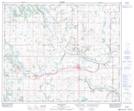
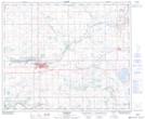
Maps showing Swimming Pond, Alberta
Swimming Pond is a Lake located in Alberta and has an elevation of 610 meters.
- Latitude: 53° 23' 36'' North (decimal: 53.3933000)
- Longitude: 110° 59' 18'' West (decimal: -110.9882999)
- Topography Feature Category: Lake
- Geographical Feature: Pond
- Canadian Province/Territory: Alberta
- Elevation: 610 meters
- GPS Coordinate Locator Map: Swimming Pond Lat/Long
Swimming Pond NTS Map Sheets