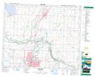
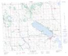
Maps showing Sylvan Creek, 11-38-28-W4, Alberta
Sylvan Creek is a River located in 11-38-28-W4, Alberta and has an elevation of 935 meters.
- Latitude: 52° 15' 26'' North (decimal: 52.2572222)
- Longitude: 113° 53' 17'' West (decimal: -113.8880556)
- Topography Feature Category: River
- Geographical Feature: Creek
- Canadian Province/Territory: Alberta
- Elevation: 935 meters
- Location: 11-38-28-W4
- Atlas of Canada Locator Map: Sylvan Creek
- GPS Coordinate Locator Map: Sylvan Creek Lat/Long
Sylvan Creek NTS Map Sheets