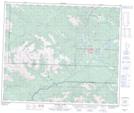
Maps showing Syncline Hills, 57-8-W6, Alberta
Syncline Hills is a Mountain located in 57-8-W6, Alberta and has an elevation of 1689 meters.
- Latitude: 53° 57' 0'' North (decimal: 53.9500000)
- Longitude: 119° 5' 48'' West (decimal: -119.0966667)
- Topography Feature Category: Mountain
- Geographical Feature: Hills
- Canadian Province/Territory: Alberta
- Elevation: 1689 meters
- Location: 57-8-W6
- Atlas of Canada Locator Map: Syncline Hills
- GPS Coordinate Locator Map: Syncline Hills Lat/Long
Syncline Hills NTS Map Sheets