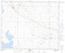
Maps showing Syson Lake, 35-12,13-W4, Alberta
Syson Lake is a Lake located in 35-12,13-W4, Alberta and has an elevation of 815 meters.
- Latitude: 52° 2' 11'' North (decimal: 52.0363889)
- Longitude: 111° 43' 43'' West (decimal: -111.7286110)
- Topography Feature Category: Lake
- Geographical Feature: Lake
- Canadian Province/Territory: Alberta
- Elevation: 815 meters
- Location: 35-12,13-W4
- Atlas of Canada Locator Map: Syson Lake
- GPS Coordinate Locator Map: Syson Lake Lat/Long