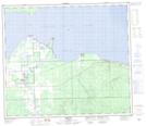
Maps showing The Narrows, 74-9-W5, Alberta
The Narrows is a Channel located in 74-9-W5, Alberta and has an elevation of 564 meters.
- Latitude: 55° 27' 32'' North (decimal: 55.4588888)
- Longitude: 115° 23' 38'' West (decimal: -115.3938889)
- Topography Feature Category: Channel
- Geographical Feature: Narrows
- Canadian Province/Territory: Alberta
- Elevation: 564 meters
- Location: 74-9-W5
- Atlas of Canada Locator Map: The Narrows
- GPS Coordinate Locator Map: The Narrows Lat/Long
The Narrows NTS Map Sheets