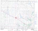
Maps showing Thomas Lake, 47,48-12-W4, Alberta
Thomas Lake is a Lake located in 47,48-12-W4, Alberta and has an elevation of 681 meters.
- Latitude: 53° 6' 22'' North (decimal: 53.1061111)
- Longitude: 111° 41' 50'' West (decimal: -111.6972221)
- Topography Feature Category: Lake
- Geographical Feature: Lake
- Canadian Province/Territory: Alberta
- Elevation: 681 meters
- Location: 47,48-12-W4
- Atlas of Canada Locator Map: Thomas Lake
- GPS Coordinate Locator Map: Thomas Lake Lat/Long