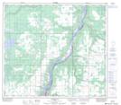
Maps showing Three Creeks, 15-85-20-W5, Alberta
Three Creeks is a Unincorporated area located in 15-85-20-W5, Alberta and has an elevation of 543 meters.
- Latitude: 56° 21' 10'' North (decimal: 56.3527777)
- Longitude: 117° 5' 1'' West (decimal: -117.0836110)
- Topography Feature Category: Unincorporated area
- Geographical Feature: Locality
- Canadian Province/Territory: Alberta
- Elevation: 543 meters
- Location: 15-85-20-W5
- Atlas of Canada Locator Map: Three Creeks
- GPS Coordinate Locator Map: Three Creeks Lat/Long
Three Creeks NTS Map Sheets