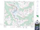
Maps showing Throne Mountain, 42,43-1,2-W6, Alberta
Throne Mountain is a Mountain located in 42,43-1,2-W6, Alberta and has an elevation of 2655 meters.
- Latitude: 52° 39' 47'' North (decimal: 52.6630555)
- Longitude: 118° 8' 21'' West (decimal: -118.1391667)
- Topography Feature Category: Mountain
- Geographical Feature: Mountain
- Canadian Province/Territory: Alberta
- Elevation: 2655 meters
- Location: 42,43-1,2-W6
- Atlas of Canada Locator Map: Throne Mountain
- GPS Coordinate Locator Map: Throne Mountain Lat/Long
Throne Mountain NTS Map Sheets