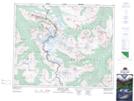
Maps showing Thunderbolt Peak, 42-2-W6, Alberta
Thunderbolt Peak is a Mountain located in 42-2-W6, Alberta and has an elevation of 2425 meters.
- Latitude: 52° 38' 47'' North (decimal: 52.6463888)
- Longitude: 118° 12' 41'' West (decimal: -118.2113888)
- Topography Feature Category: Mountain
- Geographical Feature: Peak
- Canadian Province/Territory: Alberta
- Elevation: 2425 meters
- Location: 42-2-W6
- Atlas of Canada Locator Map: Thunderbolt Peak
- GPS Coordinate Locator Map: Thunderbolt Peak Lat/Long
Thunderbolt Peak NTS Map Sheets