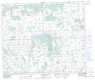
Maps showing Thunder Lake Provincial Park, 59-5-W5, Alberta
Thunder Lake Provincial Park is a Conservation area located in 59-5-W5, Alberta and has an elevation of 666 meters.
- Latitude: 54° 7' 47'' North (decimal: 54.1297221)
- Longitude: 114° 43' 41'' West (decimal: -114.7280555)
- Topography Feature Category: Conservation area
- Geographical Feature: Provincial Park
- Canadian Province/Territory: Alberta
- Elevation: 666 meters
- Location: 59-5-W5
- Atlas of Canada Locator Map: Thunder Lake Provincial Park
- GPS Coordinate Locator Map: Thunder Lake Provincial Park Lat/Long
Thunder Lake Provincial Park NTS Map Sheets