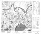
Maps showing Jimmys Slough, 113-10-W4, Alberta
Jimmys Slough is a Lake located in 113-10-W4, Alberta and has an elevation of 216 meters.
- Latitude: 58° 48' 14'' North (decimal: 58.8037780)
- Longitude: 111° 38' 32'' West (decimal: -111.6423330)
- Topography Feature Category: Lake
- Geographical Feature: Slough
- Canadian Province/Territory: Alberta
- Elevation: 216 meters
- Location: 113-10-W4
- Atlas of Canada Locator Map: Jimmys Slough
- GPS Coordinate Locator Map: Jimmys Slough Lat/Long
Jimmys Slough NTS Map Sheets