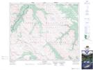
Maps showing Job Pass, 39-19-W5, Alberta
Job Pass is a Valley located in 39-19-W5, Alberta and has an elevation of 2507 meters.
- Latitude: 52° 21' 5'' North (decimal: 52.3513888)
- Longitude: 116° 45' 28'' West (decimal: -116.7577777)
- Topography Feature Category: Valley
- Geographical Feature: Pass
- Canadian Province/Territory: Alberta
- Elevation: 2507 meters
- Location: 39-19-W5
- Atlas of Canada Locator Map: Job Pass
- GPS Coordinate Locator Map: Job Pass Lat/Long
Job Pass NTS Map Sheets