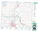
Maps showing Joffre, 9-39-25-W4, Alberta
Joffre is a Unincorporated area located in 9-39-25-W4, Alberta and has an elevation of 886 meters.
- Latitude: 52° 20' 10'' North (decimal: 52.3361110)
- Longitude: 113° 32' 14'' West (decimal: -113.5372221)
- Topography Feature Category: Unincorporated area
- Geographical Feature: Locality
- Canadian Province/Territory: Alberta
- Elevation: 886 meters
- Location: 9-39-25-W4
- Atlas of Canada Locator Map: Joffre
- GPS Coordinate Locator Map: Joffre Lat/Long