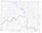
Maps showing Johnson Island, 31-21-25-W4, Alberta
Johnson Island is a Island located in 31-21-25-W4, Alberta and has an elevation of 917 meters.
- Latitude: 50° 49' 28'' North (decimal: 50.8244444)
- Longitude: 113° 27' 18'' West (decimal: -113.4549999)
- Topography Feature Category: Island
- Geographical Feature: Island
- Canadian Province/Territory: Alberta
- Elevation: 917 meters
- Location: 31-21-25-W4
- Atlas of Canada Locator Map: Johnson Island
- GPS Coordinate Locator Map: Johnson Island Lat/Long