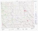
Maps showing Johnson Lake, 32-1-W5, Alberta
Johnson Lake is a Lake located in 32-1-W5, Alberta and has an elevation of 1023 meters.
- Latitude: 51° 43' 8'' North (decimal: 51.7188888)
- Longitude: 114° 7' 37'' West (decimal: -114.1269443)
- Topography Feature Category: Lake
- Geographical Feature: Lake
- Canadian Province/Territory: Alberta
- Elevation: 1023 meters
- Location: 32-1-W5
- Atlas of Canada Locator Map: Johnson Lake
- GPS Coordinate Locator Map: Johnson Lake Lat/Long