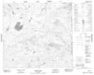
Maps showing Johnson Lake, 100-3-W4, Alberta
Johnson Lake is a Lake located in 100-3-W4, Alberta and has an elevation of 378 meters.
- Latitude: 57° 39' 39'' North (decimal: 57.6608333)
- Longitude: 110° 23' 20'' West (decimal: -110.3888889)
- Topography Feature Category: Lake
- Geographical Feature: Lake
- Canadian Province/Territory: Alberta
- Elevation: 378 meters
- Location: 100-3-W4
- Atlas of Canada Locator Map: Johnson Lake
- GPS Coordinate Locator Map: Johnson Lake Lat/Long
Johnson Lake NTS Map Sheets