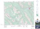
Maps showing Johnston Canyon, 26-14-W5, Alberta
Johnston Canyon is a Valley located in 26-14-W5, Alberta and has an elevation of 1506 meters.
- Latitude: 51° 15' 10'' North (decimal: 51.2527777)
- Longitude: 115° 50' 7'' West (decimal: -115.8352778)
- Topography Feature Category: Valley
- Geographical Feature: Canyon
- Canadian Province/Territory: Alberta
- Elevation: 1506 meters
- Location: 26-14-W5
- Atlas of Canada Locator Map: Johnston Canyon
- GPS Coordinate Locator Map: Johnston Canyon Lat/Long
Johnston Canyon NTS Map Sheets