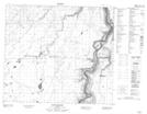
Maps showing Rapides du Joli Fou, 5-82-17-W4, Alberta
Rapides du Joli Fou is a Rapids located in 5-82-17-W4, Alberta and has an elevation of 416 meters.
- Latitude: 56° 4' 29'' North (decimal: 56.0747222)
- Longitude: 112° 37' 49'' West (decimal: -112.6302777)
- Topography Feature Category: Rapids
- Geographical Feature: Rapides
- Canadian Province/Territory: Alberta
- Elevation: 416 meters
- Location: 5-82-17-W4
- Atlas of Canada Locator Map: Rapides du Joli Fou
- GPS Coordinate Locator Map: Rapides du Joli Fou Lat/Long
Rapides du Joli Fou NTS Map Sheets