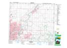
Maps showing Josephburg, 32-54-21-W4, Alberta
Josephburg is a Unincorporated area located in 32-54-21-W4, Alberta and has an elevation of 640 meters.
- Latitude: 53° 42' 48'' North (decimal: 53.7133333)
- Longitude: 113° 4' 12'' West (decimal: -113.0699999)
- Topography Feature Category: Unincorporated area
- Geographical Feature: Hamlet
- Canadian Province/Territory: Alberta
- Elevation: 640 meters
- Location: 32-54-21-W4
- Atlas of Canada Locator Map: Josephburg
- GPS Coordinate Locator Map: Josephburg Lat/Long