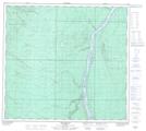
Maps showing Joslyn Creek, 95-11-W4, Alberta
Joslyn Creek is a River located in 95-11-W4, Alberta and has an elevation of 294 meters.
- Latitude: 57° 17' 25'' North (decimal: 57.2902777)
- Longitude: 111° 42' 36'' West (decimal: -111.7099999)
- Topography Feature Category: River
- Geographical Feature: Creek
- Canadian Province/Territory: Alberta
- Elevation: 294 meters
- Location: 95-11-W4
- Atlas of Canada Locator Map: Joslyn Creek
- GPS Coordinate Locator Map: Joslyn Creek Lat/Long
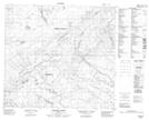
Joslyn Creek NTS Map Sheets