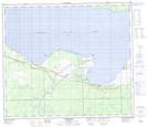
Maps showing Joussard, 33-73-13-W5, Alberta
Joussard is a Unincorporated area located in 33-73-13-W5, Alberta and has an elevation of 579 meters.
- Latitude: 55° 23' 52'' North (decimal: 55.3977777)
- Longitude: 115° 57' 8'' West (decimal: -115.9522222)
- Topography Feature Category: Unincorporated area
- Geographical Feature: Hamlet
- Canadian Province/Territory: Alberta
- Elevation: 579 meters
- Location: 33-73-13-W5
- Atlas of Canada Locator Map: Joussard
- GPS Coordinate Locator Map: Joussard Lat/Long
Joussard NTS Map Sheets