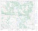
Maps showing Observation Hill, 42-6-W4, Alberta
Observation Hill is a Mountain located in 42-6-W4, Alberta and has an elevation of 681 meters.
- Latitude: 52° 39' 20'' North (decimal: 52.6555555)
- Longitude: 110° 49' 32'' West (decimal: -110.8255556)
- Topography Feature Category: Mountain
- Geographical Feature: Hill
- Canadian Province/Territory: Alberta
- Elevation: 681 meters
- Location: 42-6-W4
- Atlas of Canada Locator Map: Observation Hill
- GPS Coordinate Locator Map: Observation Hill Lat/Long
Observation Hill NTS Map Sheets