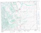
Maps showing Okotoks Mountain, 12-19-4-W5, Alberta
Okotoks Mountain is a Mountain located in 12-19-4-W5, Alberta and has an elevation of 1494 meters.
- Latitude: 50° 35' 42'' North (decimal: 50.5950000)
- Longitude: 114° 25' 56'' West (decimal: -114.4322221)
- Topography Feature Category: Mountain
- Geographical Feature: Mountain
- Canadian Province/Territory: Alberta
- Elevation: 1494 meters
- Location: 12-19-4-W5
- Atlas of Canada Locator Map: Okotoks Mountain
- GPS Coordinate Locator Map: Okotoks Mountain Lat/Long
Okotoks Mountain NTS Map Sheets