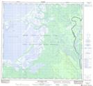
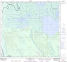
Maps showing Old Fort, 108-10-W4, Alberta
Old Fort is a Unincorporated area located in 108-10-W4, Alberta and has an elevation of 235 meters.
- Latitude: 58° 22' 59'' North (decimal: 58.3830555)
- Longitude: 111° 31' 6'' West (decimal: -111.5183333)
- Topography Feature Category: Unincorporated area
- Geographical Feature: Former Locality
- Canadian Province/Territory: Alberta
- Elevation: 235 meters
- Location: 108-10-W4
- Atlas of Canada Locator Map: Old Fort
- GPS Coordinate Locator Map: Old Fort Lat/Long
Old Fort NTS Map Sheets