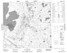
Maps showing Old Fort Bay, 111-3-W4, Alberta
Old Fort Bay is a Bay located in 111-3-W4, Alberta and has an elevation of 224 meters.
- Latitude: 58° 39' 34'' North (decimal: 58.6594444)
- Longitude: 110° 24' 18'' West (decimal: -110.4050000)
- Topography Feature Category: Bay
- Geographical Feature: Bay
- Canadian Province/Territory: Alberta
- Elevation: 224 meters
- Location: 111-3-W4
- Atlas of Canada Locator Map: Old Fort Bay
- GPS Coordinate Locator Map: Old Fort Bay Lat/Long
Old Fort Bay NTS Map Sheets