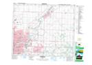
Maps showing Oldman Creek, 27-53-23-W4, Alberta
Oldman Creek is a River located in 27-53-23-W4, Alberta and has an elevation of 641 meters.
- Latitude: 53° 36' 27'' North (decimal: 53.6075000)
- Longitude: 113° 17' 59'' West (decimal: -113.2997222)
- Topography Feature Category: River
- Geographical Feature: Creek
- Canadian Province/Territory: Alberta
- Elevation: 641 meters
- Location: 27-53-23-W4
- Atlas of Canada Locator Map: Oldman Creek
- GPS Coordinate Locator Map: Oldman Creek Lat/Long