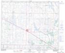
Maps showing Oliva Lake, 30-37-11-W4, Alberta
Oliva Lake is a Lake located in 30-37-11-W4, Alberta and has an elevation of 683 meters.
- Latitude: 53° 4' 41'' North (decimal: 53.0780555)
- Longitude: 111° 35' 40'' West (decimal: -111.5944443)
- Topography Feature Category: Lake
- Geographical Feature: Lake
- Canadian Province/Territory: Alberta
- Elevation: 683 meters
- Location: 30-37-11-W4
- Atlas of Canada Locator Map: Oliva Lake
- GPS Coordinate Locator Map: Oliva Lake Lat/Long