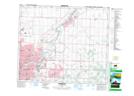
Maps showing Oliver, 5-54-23-W4, Alberta
Oliver is a Unincorporated area located in 5-54-23-W4, Alberta and has an elevation of 653 meters.
- Latitude: 53° 37' 54'' North (decimal: 53.6316666)
- Longitude: 113° 21' 50'' West (decimal: -113.3638889)
- Topography Feature Category: Unincorporated area
- Geographical Feature: Urban Community
- Canadian Province/Territory: Alberta
- Elevation: 653 meters
- Location: 5-54-23-W4
- Atlas of Canada Locator Map: Oliver
- GPS Coordinate Locator Map: Oliver Lat/Long