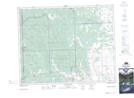
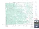
Maps showing Olson Ridge, 13,14-29-7-W5 to 21-30-7-W5, Alberta
Olson Ridge is a Mountain located in 13,14-29-7-W5 to 21-30-7-W5, Alberta and has an elevation of 1425 meters.
- Latitude: 51° 30' 37'' North (decimal: 51.5102777)
- Longitude: 114° 53' 23'' West (decimal: -114.8897222)
- Topography Feature Category: Mountain
- Geographical Feature: Ridge
- Canadian Province/Territory: Alberta
- Elevation: 1425 meters
- Location: 13,14-29-7-W5 to 21-30-7-W5
- Atlas of Canada Locator Map: Olson Ridge
- GPS Coordinate Locator Map: Olson Ridge Lat/Long
Olson Ridge NTS Map Sheets