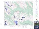
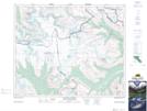
Maps showing Cline Pass, 38-21,22-W5, Alberta
Cline Pass is a Valley located in 38-21,22-W5, Alberta and has an elevation of 2600 meters.
- Latitude: 52° 14' 31'' North (decimal: 52.2419444)
- Longitude: 117° 0' 3'' West (decimal: -117.0008332)
- Topography Feature Category: Valley
- Geographical Feature: Pass
- Canadian Province/Territory: Alberta
- Elevation: 2600 meters
- Location: 38-21,22-W5
- Atlas of Canada Locator Map: Cline Pass
- GPS Coordinate Locator Map: Cline Pass Lat/Long
Cline Pass NTS Map Sheets