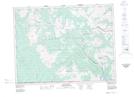
Maps showing Cloudy Ridge, 3-30-W4, Alberta
Cloudy Ridge is a Mountain located in 3-30-W4, Alberta and has an elevation of 2100 meters.
- Latitude: 49° 10' 15'' North (decimal: 49.1708333)
- Longitude: 113° 59' 53'' West (decimal: -113.9980556)
- Topography Feature Category: Mountain
- Geographical Feature: Ridge
- Canadian Province/Territory: Alberta
- Elevation: 2100 meters
- Location: 3-30-W4
- Atlas of Canada Locator Map: Cloudy Ridge
- GPS Coordinate Locator Map: Cloudy Ridge Lat/Long
Cloudy Ridge NTS Map Sheets