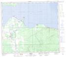
Maps showing Coal Mine Creek, 8-73-9-W5, Alberta
Coal Mine Creek is a River located in 8-73-9-W5, Alberta.
- Latitude: 55° 18' 30'' North (decimal: 55.3083333)
- Longitude: 115° 20' 43'' West (decimal: -115.3452778)
- Topography Feature Category: River
- Geographical Feature: Creek
- Canadian Province/Territory: Alberta
- Location: 8-73-9-W5
- Atlas of Canada Locator Map: Coal Mine Creek
- GPS Coordinate Locator Map: Coal Mine Creek Lat/Long
Coal Mine Creek NTS Map Sheets