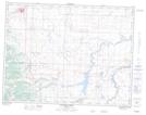
Maps showing Cochrane Lake, 30-4-27-W4, Alberta
Cochrane Lake is a Lake located in 30-4-27-W4, Alberta and has an elevation of 1156 meters.
- Latitude: 49° 19' 44'' North (decimal: 49.3288889)
- Longitude: 113° 36' 58'' West (decimal: -113.6161111)
- Topography Feature Category: Lake
- Geographical Feature: Lake
- Canadian Province/Territory: Alberta
- Elevation: 1156 meters
- Location: 30-4-27-W4
- Atlas of Canada Locator Map: Cochrane Lake
- GPS Coordinate Locator Map: Cochrane Lake Lat/Long
Cochrane Lake NTS Map Sheets