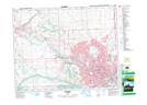
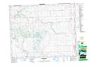
Maps showing Cochrane Lake, 27,34-26-4-W5, Alberta
Cochrane Lake is a Lake located in 27,34-26-4-W5, Alberta and has an elevation of 1286 meters.
- Latitude: 51° 14' 42'' North (decimal: 51.2450000)
- Longitude: 114° 29' 7'' West (decimal: -114.4852777)
- Topography Feature Category: Lake
- Geographical Feature: Lake
- Canadian Province/Territory: Alberta
- Elevation: 1286 meters
- Location: 27,34-26-4-W5
- Atlas of Canada Locator Map: Cochrane Lake
- GPS Coordinate Locator Map: Cochrane Lake Lat/Long
Cochrane Lake NTS Map Sheets