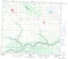
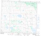
Maps showing Colquhoun Creek, Alberta
Colquhoun Creek is a River located in Alberta and has an elevation of 851 meters.
- Latitude: 55° 18' 0'' North (decimal: 55.3000000)
- Longitude: 119° 6' 25'' West (decimal: -119.1068999)
- Topography Feature Category: River
- Geographical Feature: Creek
- Canadian Province/Territory: Alberta
- Elevation: 851 meters
- GPS Coordinate Locator Map: Colquhoun Creek Lat/Long
Colquhoun Creek NTS Map Sheets