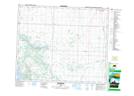
Maps showing Conjuring Creek, 1-49-27-W4, Alberta
Conjuring Creek is a Unincorporated area located in 1-49-27-W4, Alberta and has an elevation of 750 meters.
- Latitude: 53° 11' 33'' North (decimal: 53.1925000)
- Longitude: 113° 48' 2'' West (decimal: -113.8005555)
- Topography Feature Category: Unincorporated area
- Geographical Feature: Former Locality
- Canadian Province/Territory: Alberta
- Elevation: 750 meters
- Location: 1-49-27-W4
- Atlas of Canada Locator Map: Conjuring Creek
- GPS Coordinate Locator Map: Conjuring Creek Lat/Long