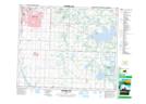
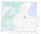
Maps showing Cooking Lake, 51-21,22-W4, Alberta
Cooking Lake is a Lake located in 51-21,22-W4, Alberta and has an elevation of 738 meters.
- Latitude: 53° 25' 59'' North (decimal: 53.4330555)
- Longitude: 113° 1' 45'' West (decimal: -113.0291666)
- Topography Feature Category: Lake
- Geographical Feature: Lake
- Canadian Province/Territory: Alberta
- Elevation: 738 meters
- Location: 51-21,22-W4
- Atlas of Canada Locator Map: Cooking Lake
- GPS Coordinate Locator Map: Cooking Lake Lat/Long
Cooking Lake NTS Map Sheets